It’s hard to know where to begin discussing this incredible adventure to the summit of one of Guatemala’s most famous — and challenging — volcanoes: Acatenango. Do I start with the lava? The hike? The exhaustion and, yes, pain after descending? This was all of the above.
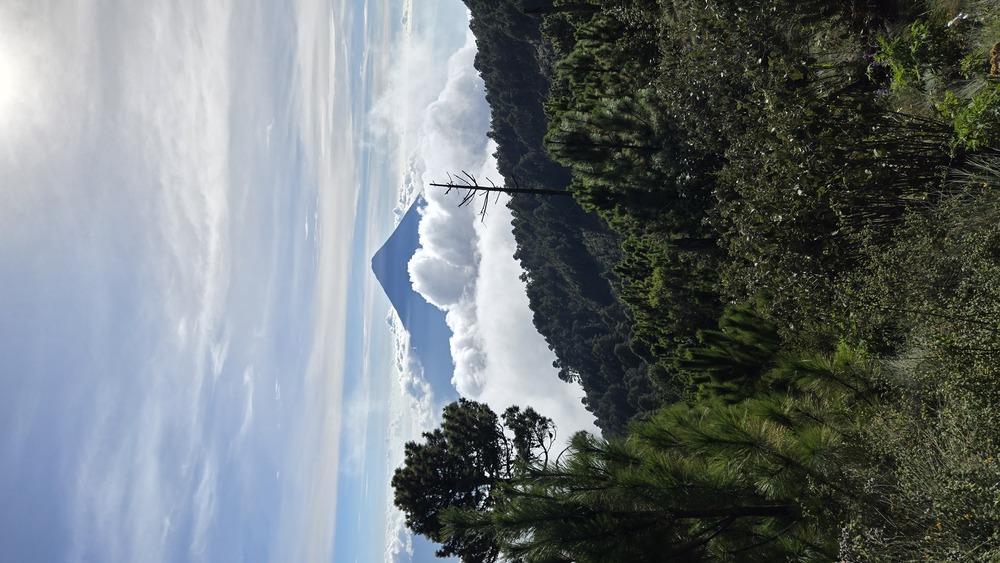
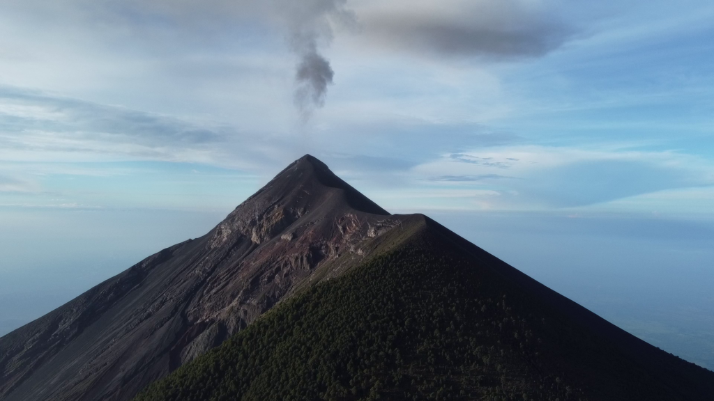
Acatenango. Just mouthing the name feels weighty. Its massive cinder cone straddles three departamientos, rising up to just over 13,000 feet and dominating the landscape. However the real show isn’t on Acatenango, but nearby Volcán Fuego, which regularly erupts, sending ash clouds high into the sky and lava cascading down its slopes. That’s why people make the exhausting 6-7 hour hike up to the basecamp: To watch the fireworks show.
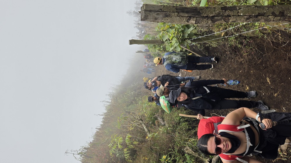
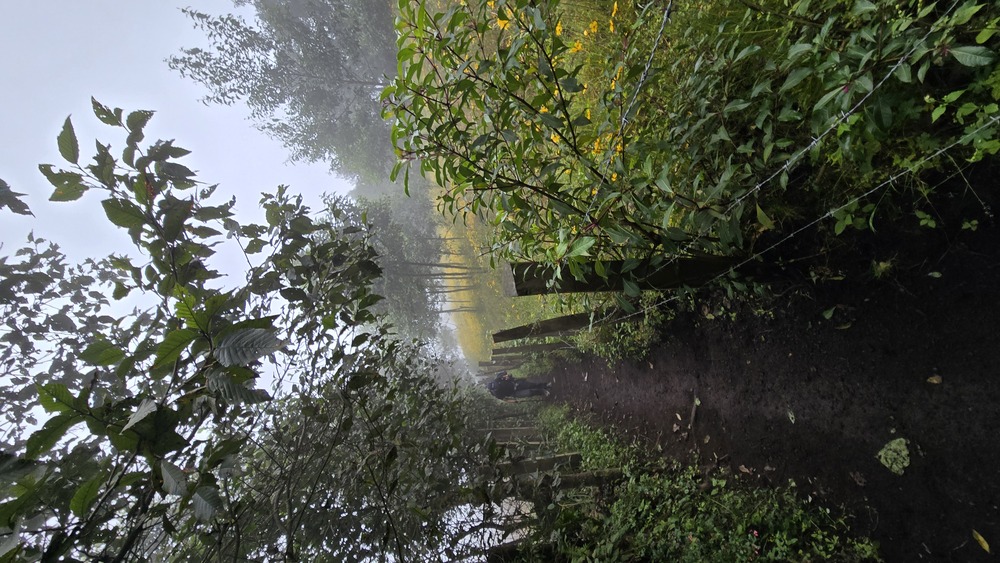
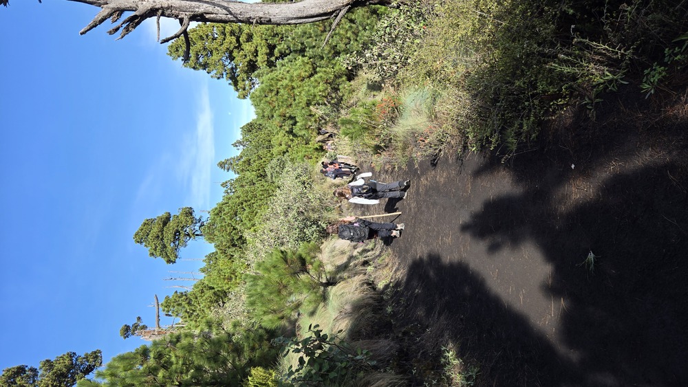
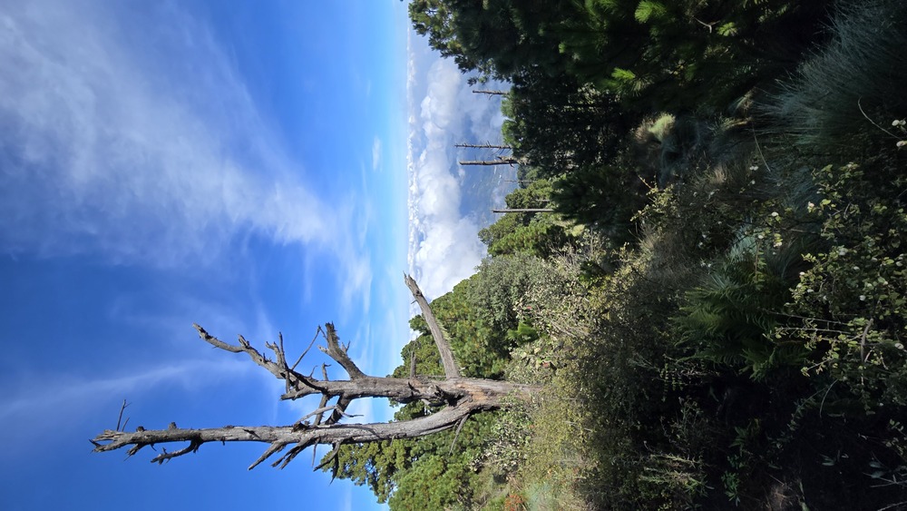
The hike, no beating around the bush, is a grueling one, steep incline the entire way, but it’s not precipitous. In the beginning, the trail rises up through milpas, traditional fields planted with corn, beans, and squash. Farmers wave, livestock watches quizzically, and for me, hiking in mid-November, everything was covered with carpets of bright yellow flowers. The trail is wide enough for groups of people to hike side by side, though it narrows and gets harder after the fields end.
Soon, you’re in the cloud forest, the land of the Resplendent Quetzal, Guatemala’s national bird. The constant talking and loud Bluetooth speakers playing meant little chance of spotting one of these rare birds, but they’re there, hidden in trees so moss-covered and gnarled that they look CGI generated, unreal. Finally, the dense forest turns to pines and scrub near the basecamp.
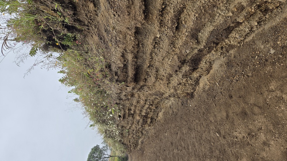
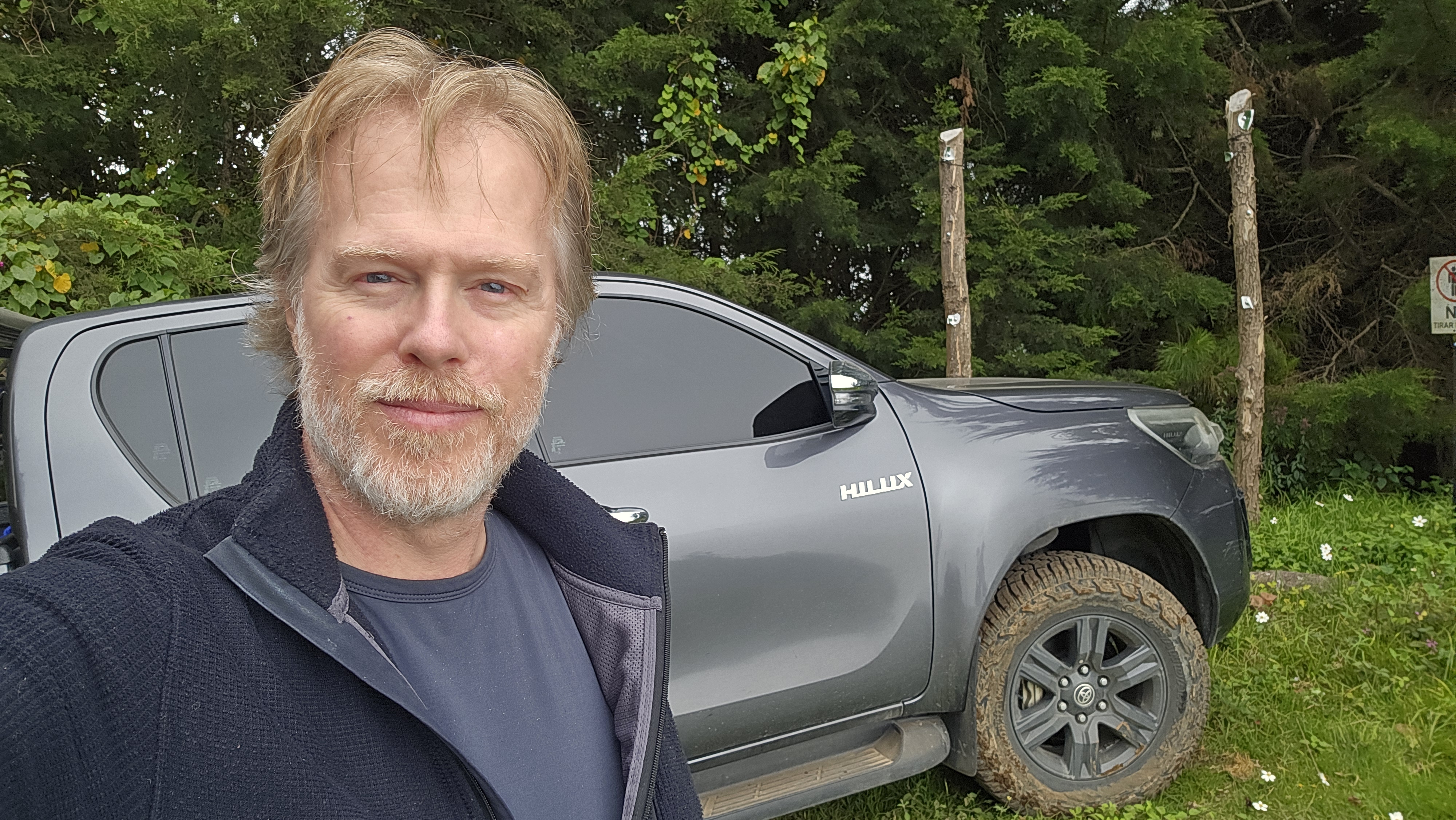
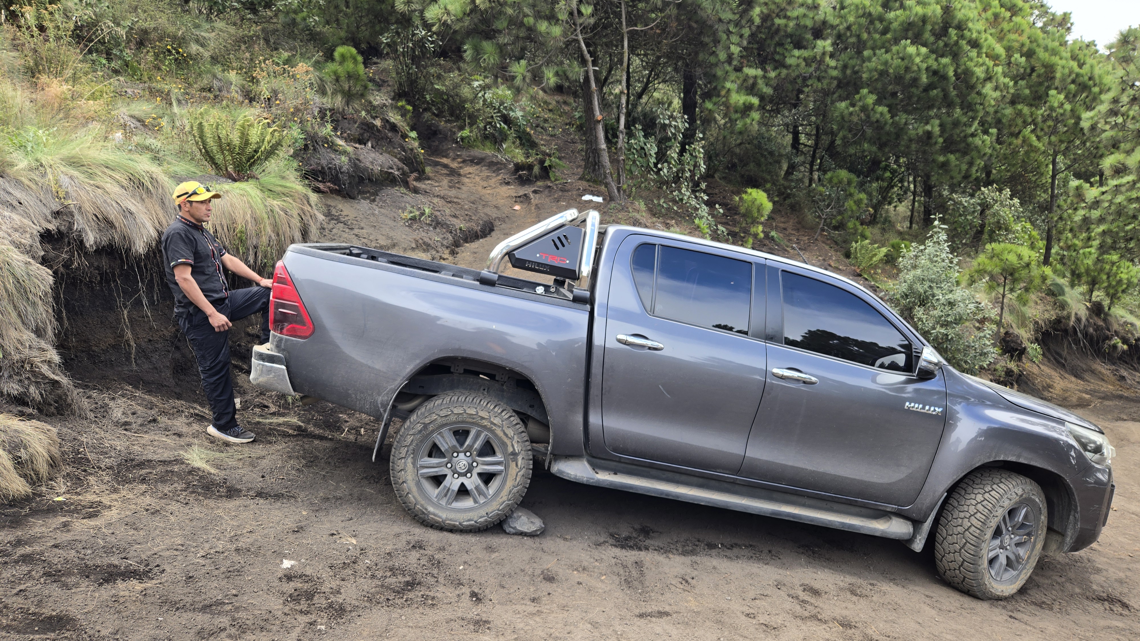
For those not pinching pennies, there’s an alternate option, ascending in a 4×4 most of the way. This was what I chose, and while it zipped me up in about an hour to the parking area, thus saving a lot of time, it was no easy ride. The trail is deeply rutted, steep enough to press you back against the seat, and often jounces over logs that are the only way to keep the ash-dirt mixture in place. One of the bounces slammed me hard on my coccyx, which reminded me of its mistreatment for the rest of the trip.
At the parking area, my guide (Marlon of GemTrips) and I were lightheaded from the altitude. We were close to 13,000 feet, not quite there yet, but gaining that much altitude so quickly may have been unwise. I was winded even just putting my backpack on, and soon after starting to hike I had to stop and rest, leaning heavily on my borrowed hiking poles. Which surprised me, because I have good lungs and have never had altitude issues before.
But it got worse.
When we finally reached the base camp, I was truly done. The view of Fuego was the reward, but all I wanted to do was sit and rest and recuperate.
Luckily, there wasn’t much that one needed to do. It was late afternoon, and clouds rolled in, obscuring the view of the erupting volcano. Even so, when Fuego hiccuped it was jarring, the sound of a serious thunderclap, followed by musical tinkling of glass — the lava, solidifying in the air, raining down on the slope as it cooled.
I flew my drone out for a faraway peek, but mostly just rested. The light faded. It got cold. Marlon had said it might get down to below zero, and while I don’t think it got quite that low, it was certainly cold enough that I was glad to have brought my thin down parka, gloves, and a knit cap.
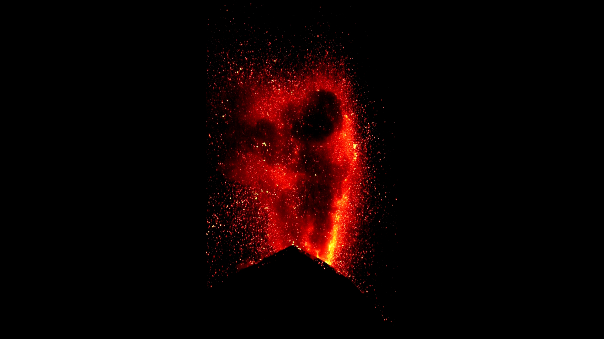
And as darkness gathered, the eruptions got better. And better. I realized that the full majesty of Fuego is only visible at night. It’s impressive, even far away in the center of Antigua, to see a puff of ash rise thousands of feet into the sky, eventually dissipating in the wind. But to be so close, and to — as it got darker — be seeing the glowing molten lava, that was a different kind of show entirely. I’ve never looked at lava erupting before, even though I’ve seen many ash clouds, especially from my travels around the Pacific’s Ring of Fire.
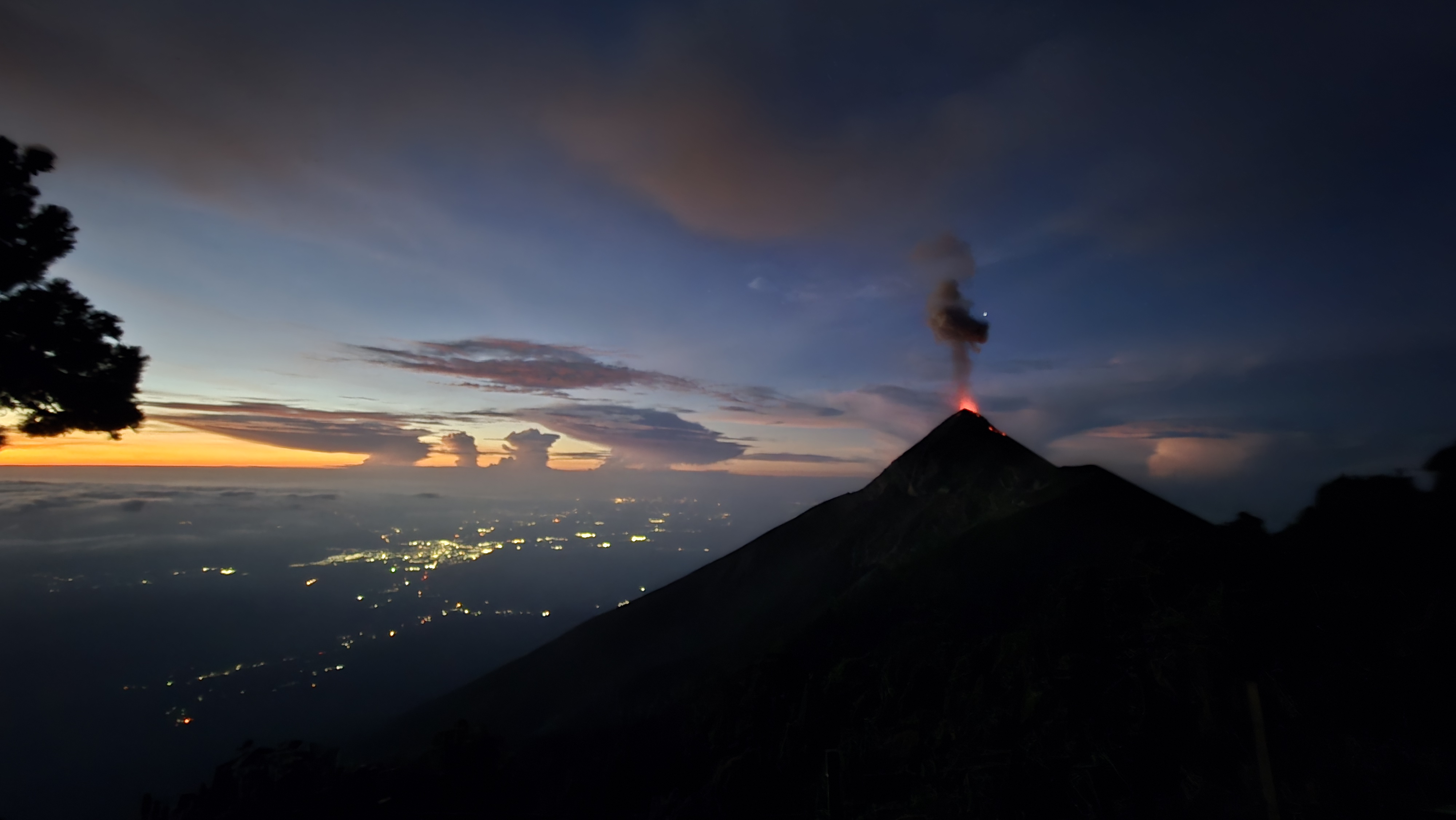
The lava was vivid orange, glowing, shimmering, and weirdly, almost floating as it fell: I think because it’s light and airy and will become pumice once it has cooled, it didn’t look like it was falling at the right speed. It drifted down in lazy arcs, hitting the slopes with a lovely tinkling sound each time, sometimes rolling for hundreds of yards down the slope before the glow finally faded.
As it got darker, the clouds began to light up with a show all their own: An electrical storm, perhaps heightened by the ash in the air, went on for hours, sending fingers of brilliant lavender light across the sky, spiderweb after spiderweb, sometimes almost as if the volcano and sky were having a competition as to who could be more impressive.
It was unreal, otherworldly, awesome, and left me breathless. I was so glad to have prepared properly for the cold and for my video and camera equipment. Everything worked, and the footage I captured still fills me with that same sense of awe every time I look at it.
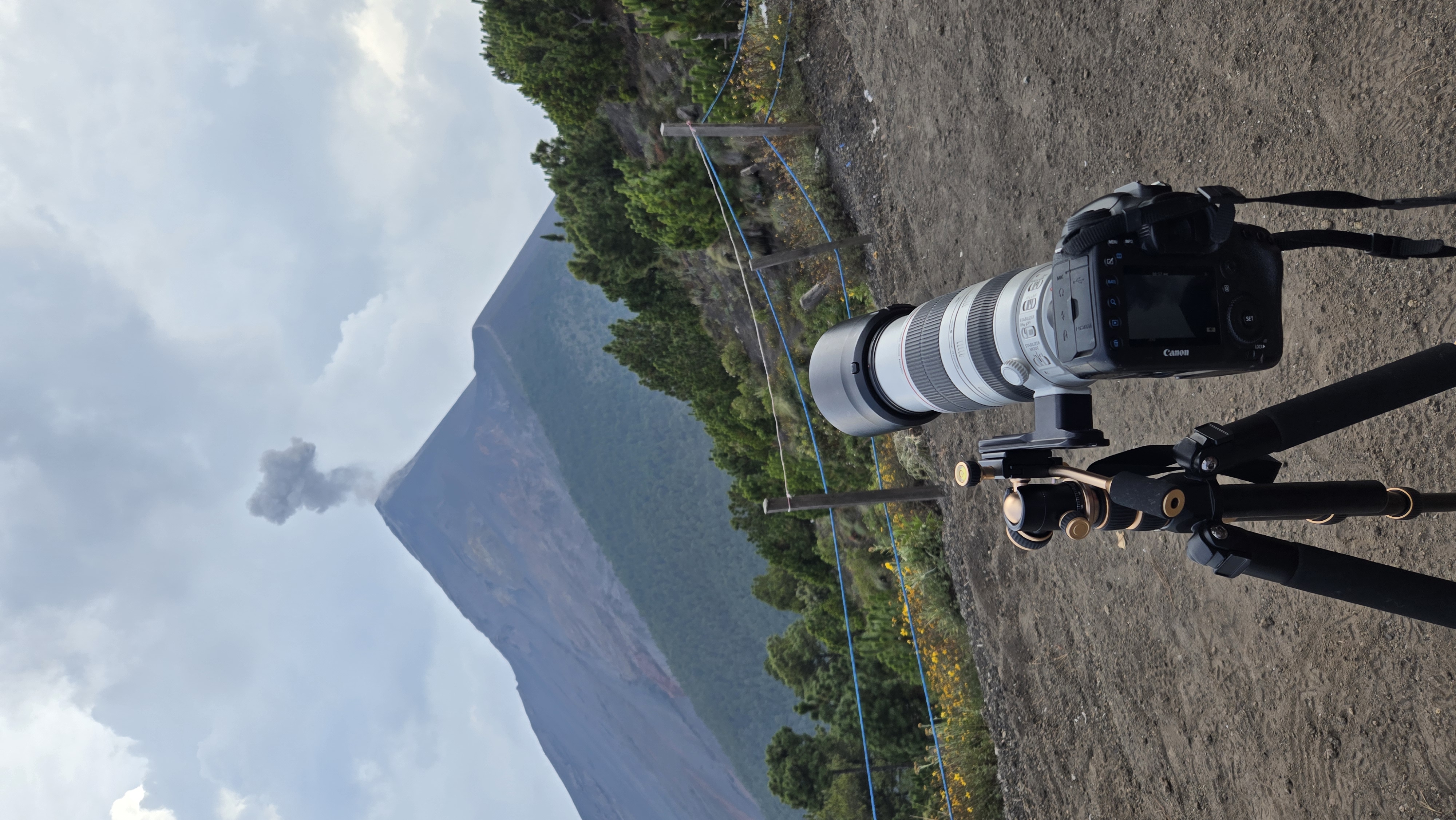
But there’s a darker side to this adventure, one that is easily seen in the video: A large row of lights to the right side of Fuego, where as many as a hundred visitors cross over a saddle that lies between Acatenango and Fuego so as to get even closer to the lava eruptions. What the guides don’t say, and what the mismanagement of this experience creates, is an accident waiting to happen. Each of these people, both guides and visitors, are well inside the death zone were Fuego to have a larger, more significant eruption. Watching that night, several times I could see lava falling dangerously close to the group, and several lights went insanely close to the lava. While on one hand, I get it, I understand the urge to see this spectacle as close as possible and I’m sure those without a 400mm lens (like I had) need to get much closer to do this justice on a cell phone. On the other hand, they are literally risking their lives. It’s unbelievable, a real shame and leaves a bad taste in the mouth, that INGUAT would let this practice continue despite the risks involved, both to visitors and guides.
(And sure enough, while it didn’t happen while I was there, several weeks later, some hikers were actually burned and had to be evacuated. This is a shame, because it will surely be the local guides who take the blame, when really it’s a broader problem of rapacious tourism superseding caution and control. The lack of regulation means that there is trash scattered up and down the trail, people are allowed to hike with Bluetooth speakers blaring, and there’s very little sanitation: (mostly you just find a tree) at the base camp. With this being one of Guatemala’s prime, most majestic sites, one would expect better management and at the very least, regulations that don’t endanger guides and visitors.)
Still, problems aside, assuming you opt to stay safely out of Fuego’s kill zone, this was an experience like nothing I’ve ever had before, something I’m thrilled to have been able to do, and worth every bit of the adventure and agony. I’m optimistic that I’ll be able to get back there soon, and when I do, I’ll have an even better handle on making the photos and videos of a lifetime…without needing to risk my life getting too close to Fuego’s fire.
Leave a Reply