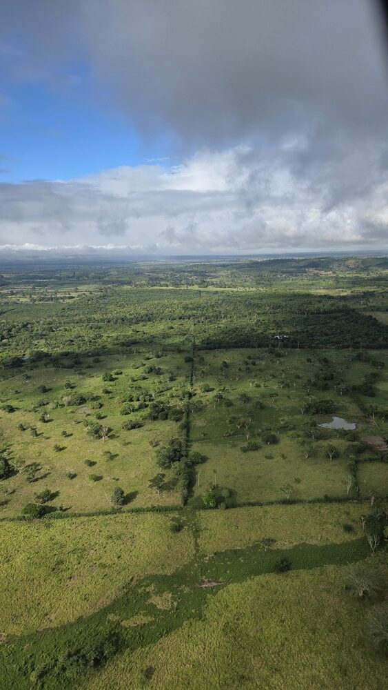
It seems like only yesterday I was taking this same trip, riding in a 6 person helicopter for an hour over the farms and treetops, finally arriving at El Mirador, a remote Maya ruin buried in Guatemala’s Petén region. But nearly 8 years had passed. I still felt the same giddy, boyish excitement putting on the headphones and strapping myself into the chair with the 5-point seatbelt. The pilot started the engine, the rotors began to move, faster and faster until they had vanished. The bird lifted off, and we were airborne. A dream come true — twice — thanks to the research needs of my publisher.
The ruin may not be Guatemala’s least frequented, as I’ve been to Naranjo and hope, someday, to make it to Nakum. Those can only be accessed at certain times of the year by 4×4 vehicles or horseback, and as they lie off the beaten track and are near enough to popular sites like Tikal and Yaxhá, most tourists just don’t want to take the time. El Mirador, on the other hand, is pretty easy to get to if you’re willing to pony up the price of the helicopter tour. As such, it unfortunately ends up being a ruin for the 1%, which is a shame, since it’s such a spectacular place that even locals should be able to enjoy.
You can get there by foot, too, an intense (and still costly) 5- or 7-day trek through the jungle, which I’ve wanted to do as well, just have never had the time. (The thought of the mosquitoes and Leishmaniasis-carrying sand flies doesn’t thrill me either. But bring on the snakes, the spiders, the scorpions, all those creepy crawlies are things I love seeing no matter where I am.)
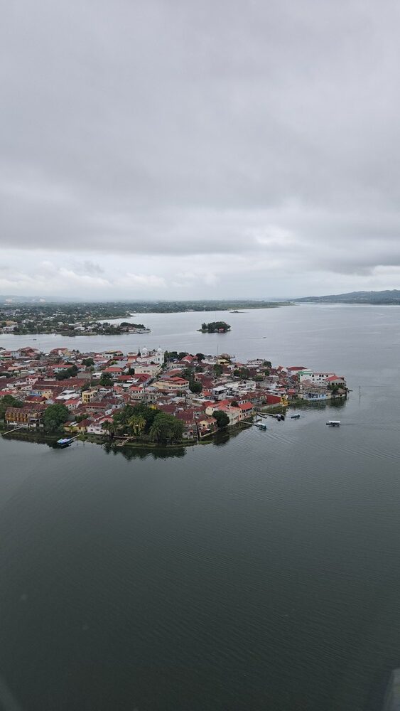
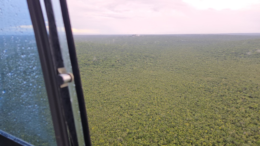
The first time I went to El Mirador it was perfect weather; this time it definitely wasn’t. Perhaps I should have made a proper sacrifice to Chaak, the Maya god of rain. We had to delay the departure by a half hour in hopes of better weather, and as we crossed the placid waters of Lago Petén Itzá it started sprinkling, then raining…then raining harder and harder. Luckily the visibility was still fine, because these craft don’t have instruments like radar and depend on visuals to be able to stay in the air. When we were flying over farms and fields it wasn’t as much of an issue, but a serious cloud or fogbank over the jungle could have meant disaster.
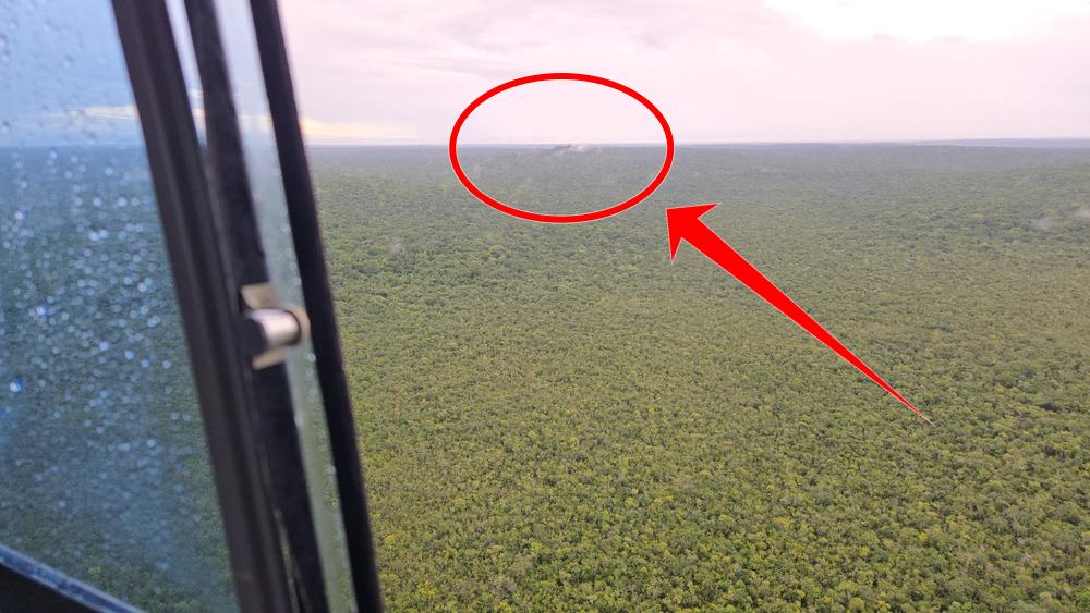
After an hour that went by far too quickly, I could see the unmistakable shape of La Danta, a small mountain, rising above the rest of the green. We were nearly there.
Here’s a video of the landing, which always amazes me: That little postage stamp of green is actually more like the size of a football field, it’s just dwarfed by the massiveness of the surrounding jungle. These places are vanishing; to be able to see it, still untouched, means a lot to me.
We landed in the rain and scooted under the camp shelter, where we got some supplies (bottled water, and ponchos for the lucky). Then we headed off into the ruin, already drenched, but it was so warm that being wet didn’t really matter. I was glad to have not brought my telephoto and DSLR this time, as they too would have been soaked. Everything was. Welcome to the Maya world.
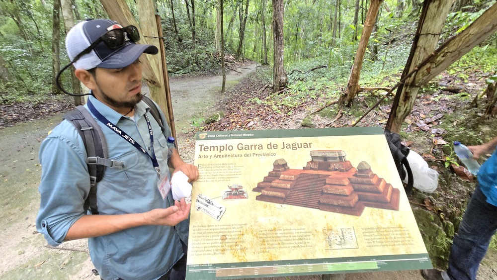
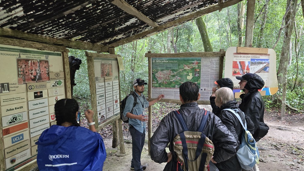
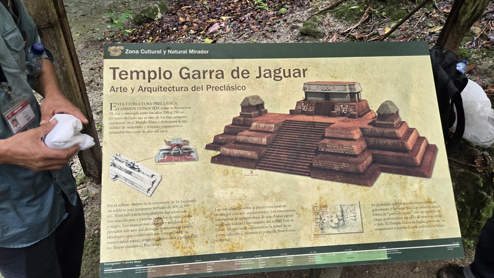
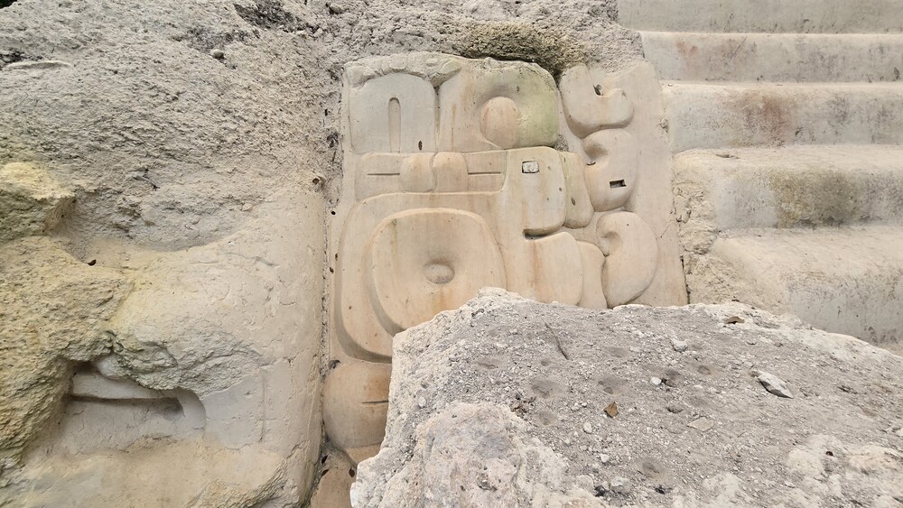
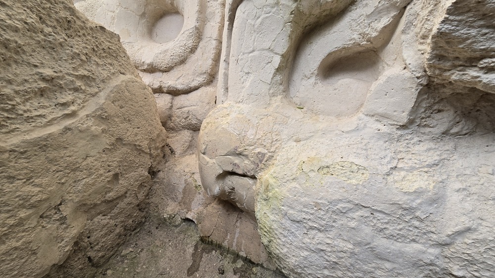
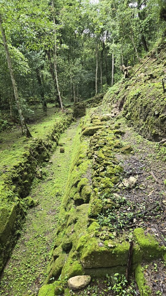
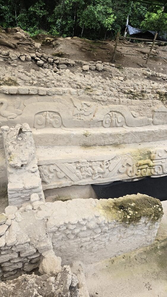
The site is spread out over several kilometers, with the tour visiting a number of smaller excavations before arriving at La Danta, the main (and towering) attraction. My favorite is an incredible frieze that’s been uncovered of the two brothers in the Popol Vuh, the Maya creation myth, swimming out of Xibalba. It’s incredibly well preserved and looking at it makes it easy to imagine what this site must have been like two thousand years ago.
Just that, its age, to be walking on roads and visiting structures that were created two thousand years ago fills me with awe and wonder. But to be the only people wandering this vast, forgotten place is even more special. Thank god there are still places in the world too remote for bus tours. In fact, if not for chicle (rubber) hunters wandering the jungle in search of giant rubber trees, this ruin might still lie undiscovered, though perhaps recent LIDAR imagery would have spilled the secret. The chicle hunters returned from weeks in the bush with stories about a forgotten city, and only in the early 1960s did the ruin begin to get attention from archaeologists.
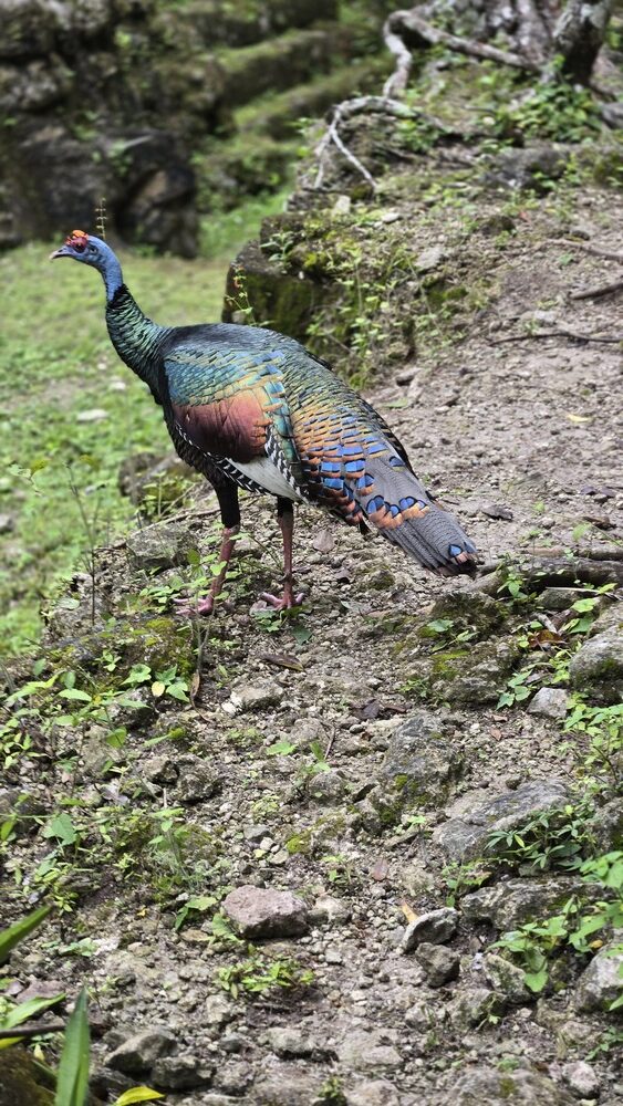
As it was raining pretty much the entire time, I didn’t see the variety of birds I’d hoped to, but got some great up-close-and-personal pics of the oscillated turkeys, which roam the jungle like giant chickens. They’re stunning, and in the sunlight the iridescence in their feathers is spectacular.

Finally, after an hour or so of exploring, we arrived at La Danta (The Tapir, in English), by some accounts the largest pyramid in the Maya world. (This is a bit tricky to calculate, as the highest is Toniná, but with the qualification that some of that height (much of it, according to Wikipedia), is from the hilltop it stands on. Second to that is La Danta, which has the qualifier of only being 33 meters in height if one doesn’t include the base. At the ruin, the guides claim — and it seems legitimate — that this is the largest man-made structure by volume in the Maya world…but wait, there’s more: According to Wikipedia, the Great Pyramid at Giza has a volume of 2.6 million cubic meters. La Danta’s volume is listed as 2.8 million cubic meters. So we’re ascending one of the largest pyramids on the planet. (Cholula’s pyramid may be the winner by volume, though exact volume isn’t listed in the Wikipedia page.)
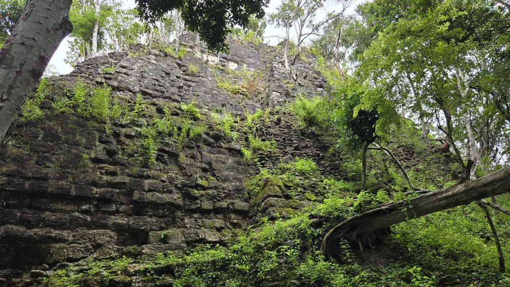
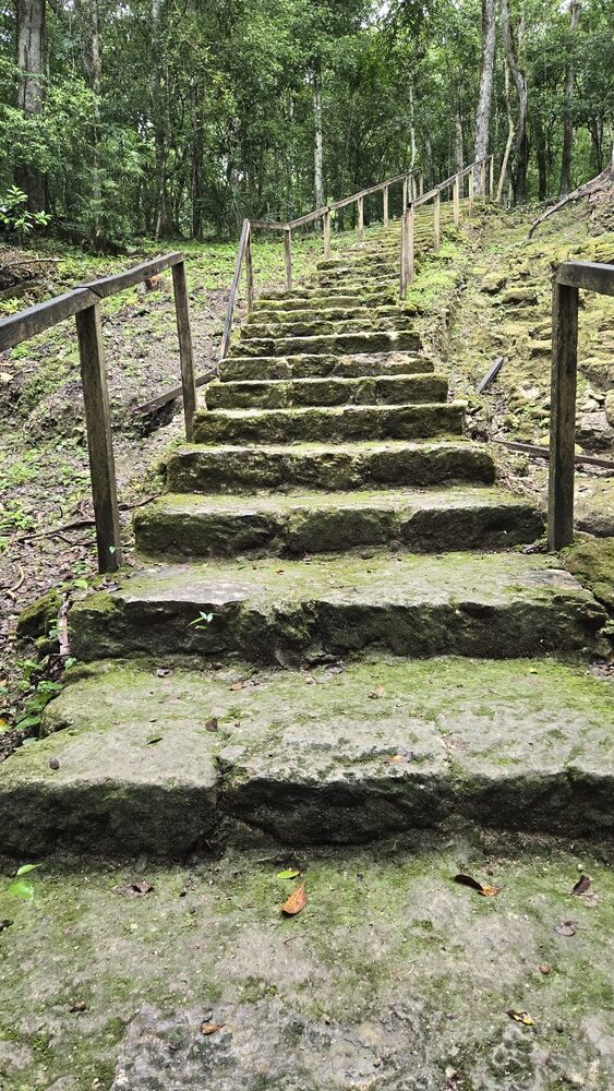
Regardless of whether La Danta is the superlative fill-in-the-blank-here (biggest, tallest, widest, etc.), it’s big. So big that to reach the top you have to ascend three different stairways in the jungle, with the actual summit disappearing in the clouds. By the time you reach the place where you can see the top, it almost looks small (smaller in the photo, as I had to use a wide angle setting to get it all in the frame).
The top. We had a brief moment of no rain and then…it sprinkled again, making the view of Calakmul (Mexico’s neighboring jungle ruin, once a quiet, peaceful place…now permanently ruined by the Maya Train project and the, yes, bus tours. Drones flying, people leaving trash, it’s criminal what Mexico has done to their own patrimony.)
The last part of La Danta has a fairly well-constructed stairway to ascend on, though the wooden steps were wet and at times slippery. What was frustrating was that several people on the tour were being very cavalier about the guide’s repeated cautions about it being slippery, and sure enough, on the way back down, a guy fell and fell hard. He lay on the mossy steps writhing in pain for a few moments, unable to get up, while the rest of us envisioned having to cut our expensive tour short and MedFlight him back to a Flores hospital. Luckily, the guy was probably a professional soccer player: After moaning and flailing as if he would need a leg amputated, when he saw the ref wasn’t having it he got to his feet and was basically fine.
I couldn’t have sympathized more with the guide, who confided that he’d been telling that exact same guy repeatedly to be more careful on the treacherous stones. The guy had curtly dismissed the guide with a, “I’m not a child, I know what I’m doing, thank you” and clearly didn’t.
For those of you out there wondering how you can enrich your travel, be safer, and have more fun, here is a huge tip:
Always listen to the locals.
And always treat them with respect.
I can’t say that enough, nor say the countless times I’ve seen Westerners ignoring locals, insulting locals, or thinking locals are stupid or that they don’t know what’s what. The hubris (and yes, sometimes racism, I’ll be frank) never ceases to amaze me. It’s no wonder that every language in the world has a word for “the clueless white foreigner.” Here it’s gringo. In Japan it’s gaijin. In Tanzania, mzunga. The degree of “clueless” is often in the usage and intonation, but for travelers, please, do yourself a favor and respect the locals, heed their suggestions, and know that they know vastly more than you do about what to do and not do.
As we got back to the camp, however, a new difficulty presented itself: The rainclouds were so low to the trees that it was impossible for the copter to take off safely. At first I thought they were joking, but soon it was clear: If they didn’t lift soon, we might have to camp here overnight.
Which actually would have been delightful, though I would have loved to have had a dry pair of underwear and perhaps a flask of something to sip around the campfire. I’d brought nothing, just my phone and a plastic bag to keep it dry in, and staying overnight would have been soggy, if not worse.
There was nothing to do but wait, and luckily, after an hour and half of chit-chatting at the picnic tables and eating sandwiches the tour provided, the pilot stood up and said, “Vamanos! Vamanos! Let’s go!” and hurried us to the helicopter as if we were being evacuated before a missile strike. In seconds we were airborne again, and the pilot (sadly, instead of circling one last time around La Danta for us to take photos of) made a beeline for Flores, flying so close to the treetops it seemed like we were in danger of hitting them.
Not a moment too soon, too, because the fog was rolling in as we reached Lago Petén Itzá, and by the time we landed it was like pea soup. Impossible to see.
What an incredible visit. I couldn’t have felt luckier, though I did not mind at all being able to reach my hotel room and take a warm shower and put on some dry clothes.